Home/Applications/Satellite Map Live Earth View
Satellite Map Live Earth View

Satellite Map Live Earth View

Android GPS Driving & Voice Navigation Apps
4.0 Popularity

Satellite maps and 3D exploration

System Requirements

Updated
September 17, 2025
Age Rating
Everyone
Android
Android 7.0++
Package Name
com.satellitemap.finder.navigation.earthmap.world.voice.livetraffic.direction

I've tested a bunch of map and navigation apps, and Satellite Map Live Earth View is one of the more impressive ones I've tried. The 3D satellite view is really cool and gives you a unique perspective on different locations. The live updates and GPS features work well for getting directions or just exploring. My only real gripe is the ads can get old after a while, but you can pay to remove them. Overall, it's a pretty solid app that delivers on the promise of bringing satellite mapping to your phone.

Manya Lyalya
AUTHOR: Manya Lyalya Editor, Grand Screen

Pros

  • Tons of detail in the satellite imagery
  • 3D mode is great for visualizing terrain and landmarks
  • Free to download and use the basic features
  • Integrates with GPS for navigation
  • Regularly updated with the latest satellite data

Cons

  • Can be a battery drain if you use it a lot
  • Ads in the free version are kind of annoying
  • Learning curve to figure out all the different tools and features
  • Some areas don't have the most up-to-date satellite data
GOOGLE PLAY SCORE
4.0 /5
based on 3,455 reviews
Generally Favorable
80
MY SCORE
Hover and click to give a rating
?
Rate this app

Description

I’ve been using Satellite Map Live Earth View for a couple months now. It’s basically an app that lets you explore the world in 3D using satellite imagery. Pretty cool if you’re into geography and maps.

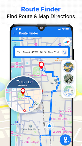
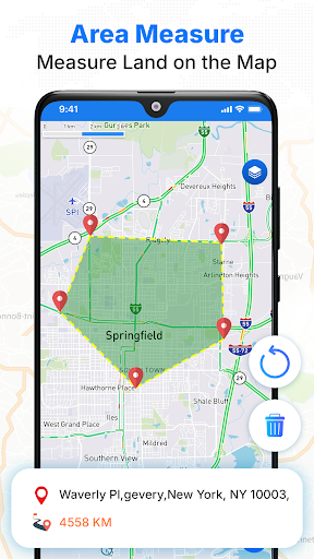
Here’s what you can do: you can view live satellite feeds, zoom in on different locations, and even get navigation features like GPS maps. There’s also a 3D mode which is pretty neat – you can see buildings and landscapes in a more immersive way. Took me a bit to figure out all the different tools but they’re pretty intuitive once you play around with it.

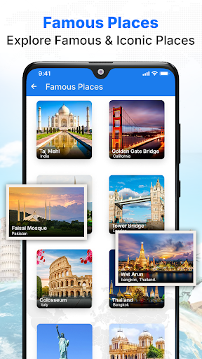
Look, if you’re into travel or just like geeking out over maps, you’ll probably enjoy this app. It’s not perfect – the free version has some annoying ads – but overall it does a solid job of bringing satellite imagery to your fingertips. Worth checking out if you’re curious about what the world looks like from up above.

Rate this app

Help others by rating key aspects of this app

Usability

50%

Features

50%

Design

50%

App Permissions

This app requires 5 permissions to function properly:

Approximate location

Data that may be shared with other companies or organizations

Precise location

Data that may be shared with other companies or organizations

Device or other IDs

Data that may be shared with other companies or organizations

App interactions

Data that may be shared with other companies or organizations

Crash logs

Data that may be shared with other companies or organizations

Frequently Asked Questions