

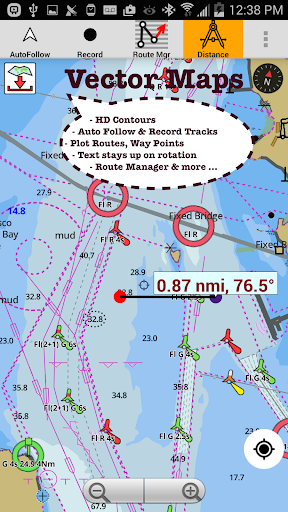


Been using i-Boating:Marine Navigation for a couple months now. It’s basically a super detailed marine navigation app with offline nautical charts, fishing maps, and boat route planning. Pretty solid if you’re into boating and fishing.
Here’s what you can do – there’s offline vector charts for the entire US coastline, as well as inland lakes and rivers. It’s got these cool depth map features that show safety depths and underwater terrain. You can also plan boat routes, save waypoints, and even get voice-guided navigation. It’s like having a dedicated marine GPS plotter right on your phone.
Look, if you spend a lot of time on the water, whether it’s fishing, sailing, or just cruising, you’ll probably get a lot of use out of this app. It’s not perfect – the interface can be a bit clunky at times and the route planning features take some getting used to. But overall, it does the job and is worth checking out if you need a good marine navigation tool.